
An Iranian cargo ship has been observed sailing in close proximity to a U.S. carrier group, led by the USS Abraham Lincoln, within the strategically vital Straits of Malacca. This interaction occurs as the U.S. carrier group reportedly transits westward through the strait, with the Iranian vessel maintaining its position nearby.
The Straits of Malacca: A Global Maritime Artery
The Straits of Malacca represent one of the world’s most critical shipping lanes. This narrow, 800-kilometer stretch of water connects the Indian Ocean to the Pacific Ocean, serving as a primary conduit for global trade. Tankers carrying oil and gas, along with countless cargo ships, pass through this waterway daily, making it central to international commerce and naval movements.
Observed Vessel Movements
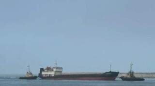
Available data indicates the Iranian cargo ship’s presence in the strait. This vessel operates near the U.S. carrier group, creating a notable maritime observation in a high-traffic zone. Such proximity between military and commercial vessels often draws attention from maritime observers.
An Iranian cargo ship was observed sailing in close proximity to the U.S. carrier group, led by the USS Abraham Lincoln, within the vital Straits of Malacca. The U.S. group transits westward through this critical global shipping lane, while the Iranian vessel maintains its position nearby, drawing maritime attention.
The USS Abraham Lincoln Carrier Group’s Transit
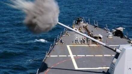
The U.S. carrier group, spearheaded by the USS Abraham Lincoln, actively navigates westward through the Straits of Malacca. Carrier groups typically comprise multiple warships, including destroyers, cruisers, and submarines, providing robust defensive and offensive capabilities. Their transits through international waters are standard procedure for global naval presence.
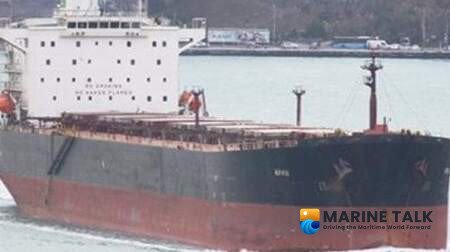
The Iranian Cargo Ship’s Position
The Iranian cargo ship’s observed position places it in the vicinity of the U.S. carrier group. Details regarding the cargo ship’s specific type or destination remain undisclosed. Its sustained presence near the U.S. naval formation forms the core of the current observation.
Monitoring Through Maritime Data
The confirmation of these vessels’ presence and proximity relies on available maritime tracking data. Such data, often sourced from automatic identification systems (AIS) and satellite imagery, offers insights into global shipping movements. These systems provide transparency for monitoring maritime traffic and ensuring navigational safety in busy waterways like the Malacca Strait.


Leave a Comment